|
Digital meets Culture https://www.digitalmeetsculture.net/article/interactive-map-of-the-aoos-valley/ Export date: Sat Jul 18 4:35:56 2026 / +0000 GMT |
Interactive map of the Aoos valley developed in INCULTUMIn INCULTUM project, there is an example of cross-borders pilots which try to explore synergies to support sustainable tourism in peripheral areas. One of these areas is the shared valley between Greece and Albania, marked by a river named Aoos on the Greek side and Vjosa on the Albanian side. Two pilots (7 and 8) are developed within INCULTUM project with the aim of modernizing the touristic and cultural promotion of this area from both sides. A first outcome of the Pilot 7. Aoos, the shared river, coordinated by the Greek partners of The High Mountains cooperative, is a nice map of the area with touristic purposes, indicating various points of interest both natural and cultural and also including local folklore. EXPLORE THE MAP HERE 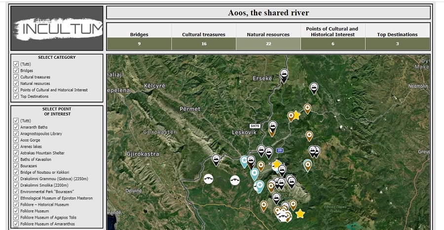 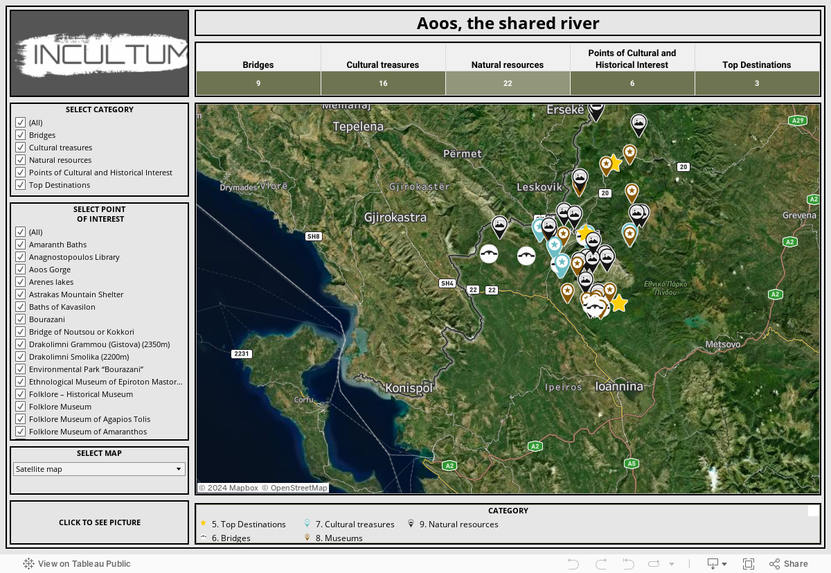 More about the Aoos Pilot: The Vjosa/Aoos River, considered as ‘one of Europe's last living wild rivers', springs from Mt. Pindus in Greece, and then enters Albania. On both sides of the river banks, extends a terrain of agrarian field terraces alternated with hilly lands of rich Mediterranean vegetation where the traditional settlements are situated, followed by high mountain massifs dominated by continental climate with rich water sources, forests, flora and fauna, and broad prominent pastures. On the Greek side, Konitsa is the main town of the area and the capital of the municipality surrounded by some of the highest mountains of Greece. It is built on the edge of Vikos Canyon, core of the National Park of Vikos-Aoos and one of the four Greek Geoparks, which became a member of the European and Global Geopark Networks in 2010. Numerous geosites within the territory are situated in landscapes of incomparable beauty. In the INCULTUM pilot 7, the main expected action relates to the mapping of the natural, social, cultural and productive resources of the area, analysis of the data gathered during the mapping and their visualization using Business Intelligence tools. With this digital platform we are going to give the ability to citizens, local authorities and stakeholders, but also to visitors, to virtually combine resources of the area and propose their own evidence-based development actions and policies. Furthermore, the database is going to be participatory and always open to new inputs, collected by questionnaires, free text, business registrations, comments for the area etc. Discover all the INCULTUM Pilots: https://incultum.eu/pilots/ |